Rolling Star
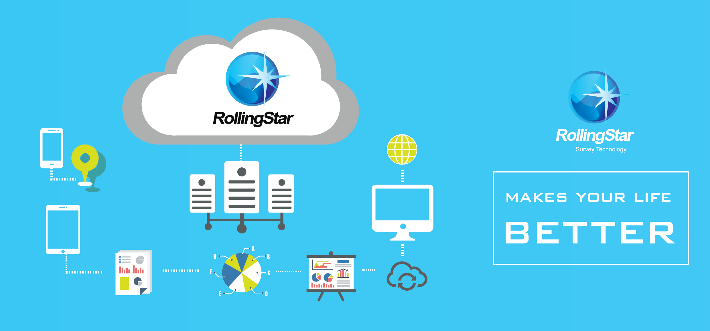
Rollingstar Survey is the most professional spatial technology provider. We have professional experience toward civilian applications such as mapping, environmental information solution, remote sensing, data analysis and disaster assessment, various utility management services and also provide integration of geospatial intelligence and cloud technology. RollingStar Survey Technology is promoting Open GIS specifications, creating innovative business application with spatial technology and providing advanced survey professional solutions and services. There are 4 domains we re-directed and focused on our business in the next stage. List as followings:
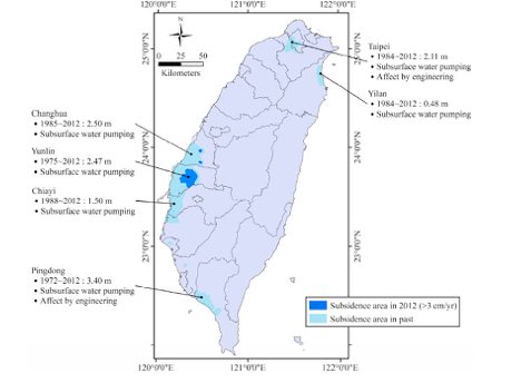 Figure 2. Distribution of land subsidence in Taiwan from 1972 to 2012 (adapted from the Water Resources Agency, Ministry of Economic Affairs, Taiwan).
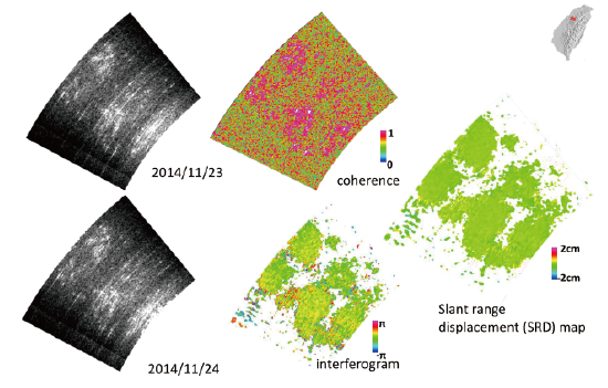
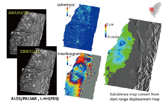 Figure 3. InSAR analysis with UltraSAX/ InDIS platform
Features of Services and Applications
Mobile Mapping Technology On-demand and Multi-payload Solution Programmable for Temporal Resolution Meet Demand on Investigation of Underground Resource Simple and EfficientPortable Client
Provide observed data and quality report Calculated output with geocoded result Portable design in field conditionPortable Server
Management for big-data Import various remote sensing data for analysis and display Support infrastructure of EPSG spatial data Store in spatial database 2D and 3D visualization Available to integrate multi-source cloud service Figure 4. RollingStar software for gravity surveying
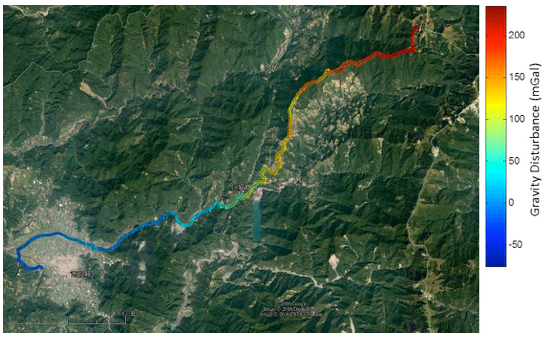 Figure 5 shows the result using land vehicle at HeHuan Mountain, Taiwan (2014 Jan.) with long-drive duration and high terrain change. According to the gravitational theory, it is reasonable that the gravity disturbance is larger when locating on higher position.
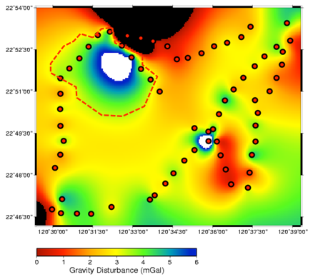 Figure 6. Detection result for groundwater resource
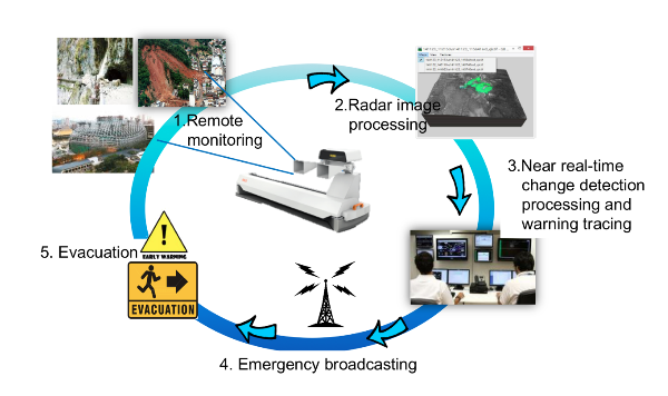 Figure 7. RollingStar MMI system operation scenairo
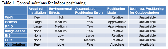 Rollingstar offers iLB solution for indoor navigation and applications. Rollingstar iLB solution using sensors embedded in smartphone and aided methods to develop positioning technology is less dependent on specific installation and environmental infrastructures. Therefore, high potential of our solution is represented to use smartphone for location-based and navigational services. iLB is a software platform solution with limited and common hardware construction. Due to unique background and know how, iLB is able to set up a totally seamless integration fields between indoor and outdoor environment. The iLB main features list as followings:
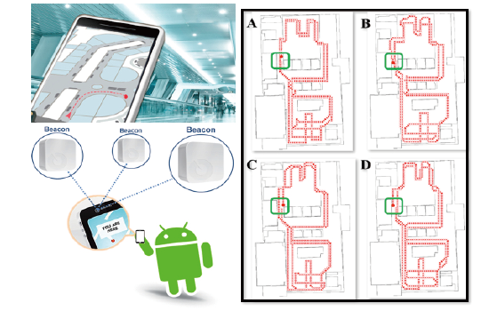 Figure 10. Test for navigation and results display
Full operational point of view. Not only for research result display, but also for real business operation.
Information technology with international standards, that means satisfy global intercourse and interoperability requirements.
Support global SDI (Spatial Data Infrastructure) service so that meets the global market and spatial management needs.
Data cloud service support end users’ multi-platforms and various development environments.
Spatial Big Data without map tiling techniques.There is no time delay and operational interruption during data registry, query, service, update and downloading.
Provide spatial data mosaics and embedded watermark service on-the-fly. No post-process required.
 See more detail.
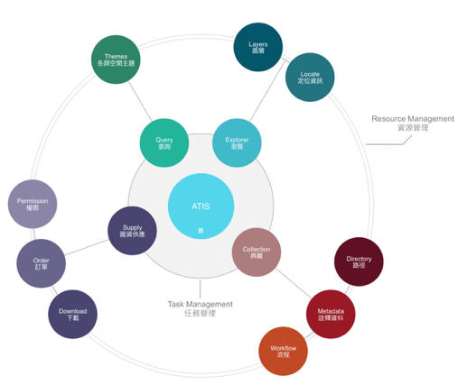 Figure 11. Four-task system model for representing each resource subject in ATIS platform design.
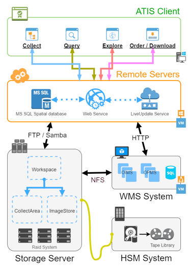 Figure 12. SOA capabilities on the ATIS platform.
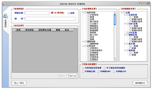 Figure 13. Modularity of ATIS Client – Setting the available function set for user privilege level switch.
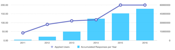 Figure 14. Total accumulated HTTP responses to WMS image requests till December 2016.
Hogazai Service shows natural spatial disaster potential information. We corporate with experts from TAPDI (Taiwan Association of Prevention Disaster Industry) and utilize government open data to make value-added for cloud service. It provides user to evaluate insurance requirements of personal properties, meanwhile, the information also deliver to insurance and re-insurance company for underwriting process.
visit Demo websiteTodegong is a platform that provide one-stop portal service for land solution. It reveals all the land-use restrictions, asset analysis, industry intelligence, object and requests match and land risk analysis service.
visit Demo website